Is Russia actually that big? Deconstructing three geographical myths
Cartography produces simplifications and distortions of reality. In a non-verbal way, maps influence our representation of the world. By fixing North and South, center and periphery, we give precise messages about the political and social division of the world.
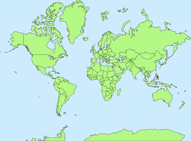
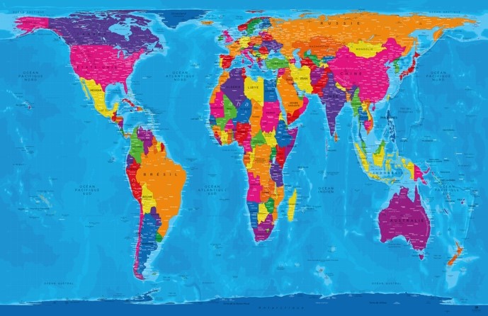
The so-called Mercator projection[1] is so rooted into our collective minds that we do not question its huge misrepresentations. Despite several publications about the bias of European mapping and a flourishing literature about alternative or corrective maps,[2] the Mercator projection is still the image most of us have of the world. Children learn about the world on it and Google Maps used the Mercator Projection from 2005 to 2018.
Yet this representation is far from being “neutral”. We will focus on three basic misrepresentations and their effect on Europe and Russia’s geopolitical imagination.
Europe at the center?
The first seemingly “neutral” concept is the central place occupied by Europe. Europe is not at the center of the world by some sort of divine right. In fact, all cultures perceive themselves to be the center of the world. Chinese cartography, for example, places China in the middle of the world and refers to itself as “Zhong Guo”, the Middle (central) Kingdom.
Starting from the 16th century, Europe was able to project its power all over the globe and with it its own representation of space. The current “multipolar” world order is proof of how this Euro-centric perception is becoming more and more obsolete. It is openly challenged by other “poles” of which Russia is a clear example with its complicated history as a “Eurasian” power.
Russia hugely benefitted from the Mercator projection, in which it prestigiously occupies the entire right upper corner. It feels both European and Asian, which gives Moscow the “natural” or “geographical” right to rule over Eurasia and participate in European civilization without totally integrating into it.[3]
Why is North up there?
The North-South divide is the most rooted geographical imaginary in human societies. In fact, before maps became an instrument to project power and hierarchizing space in the Modern Age, North was not “up there”. Christian mapping from the Middle Age was more likely to show East on top. That derived from a literal reading of the Bible that placed the Garden of Eden in the East.
Now the LORD God had planted a garden in the east, in Eden; and there he put the man he had formed.
Genesis 2:8
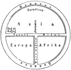
The so-called T and O maps indicated the East-Paradise on top of a three-parted world: Europe, Asia and Africa. The centrality of the Mediterranean shifted from Greek cartographers to Christian ones who associated the three parts of the world to Noah’s three sons: After the deluge, Japhet went towards Europe, Sem towards Asia and Cham towards Africa to repopulate the world.
The Christian gaze over the world placed Jerusalem at the center of the world not Europe (if there was such a thing), with the Ocean around the Ecumene.
The remains of this East-on-top mapping are to be found in our languages: we “orient” ourselves in space, (Italian orientarsi, french s’orienter etc.).
Until gravity was discovered and included in our perception of space, Europeans came up with all sorts of theories avoiding the idea of an inhabited Southern Hemisphere: Until the first Portuguese sailors went south of the equator in the 15th century, Europeans believed that the water was boiling at the Equator and that life was not possible below it. Others simply theorized a heavy counterweight at the South Pole, allowing Europeans to always stand with their heads up. Either the Earth was flat, or Europeans had to be physically on top: How could it be otherwise, if one excludes gravity? Yet, there is no objective North or South meaning up or down: All humans walk on earth with their heads up.
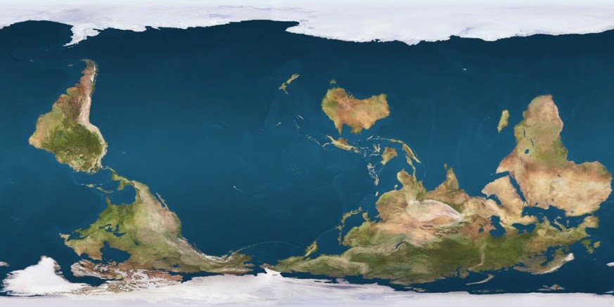
World maps could very well represent the world upside down, and without breaking any “natural” order of things. It is just a way to challenge our ethnocentric perceptions.
With his famous Corrective map of the World, Australian geographer Stuart McArthur shows the world upside down, placing Australia at the center. We immediately perceive the map as “false”, however it is just as good as ours. We are just not used to it.
Is the size of countries accurate?
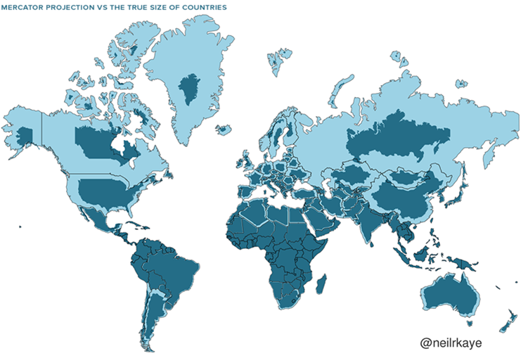
The Mercator projection was realized in the 16th century (it did not include the Americas and Oceania) and had a specific purpose: sailing. If a sailor had to travel from point A to point B, the Mercator projection offered (and still offers) the right coordinates as angles are precise. Yet, forcing a tridimensional world into a bidimensional surface means that either angles, shape or size must be adapted. Mercator sacrificed size ratio: The farther away we move from the Equator, the bigger is the difference between real land size and its bidimensional representation.
To give an idea of what size ratio amongst countries is, the Gall-Peters projection can come handy as it represents the true size of each country (at the expenses of shapes and angles).
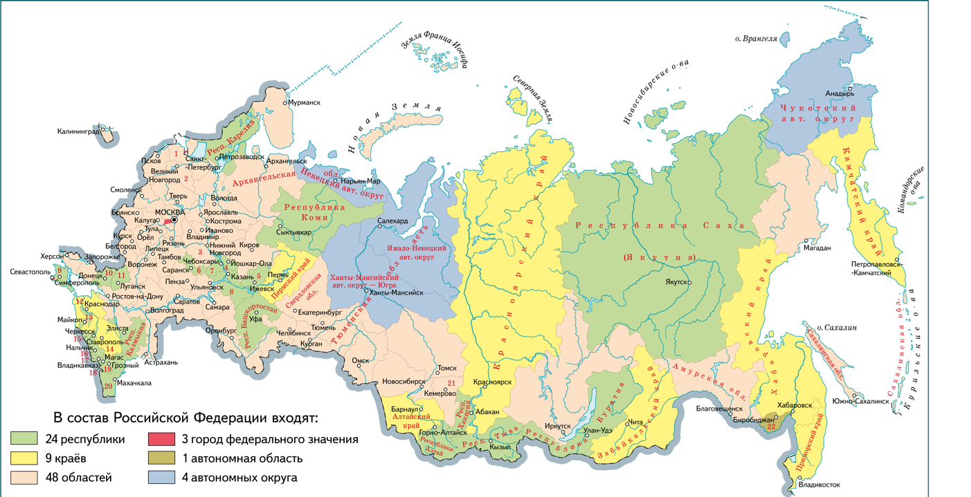
Russia is the biggest country in the world, yet this perception, magnified by classical Mercator cartography, should be nuanced. To the eye it appears to be larger than the African continent while, at surface level, the latter is almost twice as large as Russia (30,370,000 km² vs 17,234,033 km²) Russia is a little more than twice the size of Brazil (8,510,000 km²). Something impossible to visualize on the map.
Does size matter?
Russia’s size is not relevant as such, but in as much as it is often associated to social and geopolitical implications. The Mercator projection is as deeply rooted in Russian culture as it is in Europe’s. Russians love to refer to their country as “one sixth of the world’s dry land”. In fact, it amounts to just one tenth: almost half of what they believe.
Read also: Russia: the most confused nation in the world
Many in Russia and elsewhere take for granted that the country’s size should automatically entail the status of a strong center of power both politically and economically and that Russia is somehow destined to choose empire over democracy. In this imperial vision, Russia is too big to allow its provinces to develop autonomously: that would mean secession. Hence, the need to crush all pluralism, subjugate ethnicities and impose a vertical power over minds, territories and resources. As Russian historian Sergey Solovyov wrote in the 1840s: “The history of Russia is the history of a country that colonizes itself.”
As for international relations, Russia oscillates from fear of external threats to messianic self-aggrandizement. How can a country so big have no influence on the development of humankind? Was Tzarist Russia not already so rightful and big that it “bordered with God” according to German Poet Rainer Maria Rilke? Communism gave Russia the perfect ideology to imagine itself as the center of a new world, forging a new Man, homo sovieticus, and being the cradle for the World Revolution.
Putin’s Russia is again leading a civilizational struggle against the corrupted-Satanic West, its immoral tendencies, and imperial ambitions.
How maps are (mis)used to reinforce political vision
In a sequence broadcasted on Russian TV in May 2023, Putin welcomed the President of Russia’s Constitutional Court, Valery Zorkin, to his office. The latter shows him a 17th century map intended to prove that Ukraine did not exist before its creation by Russia in 1917.
In the video, Putin says: “[i]t was only after the October Revolution that various quasi-states appeared and the Soviet government created Soviet Ukraine. This is a well-known fact. Before that, there was no Ukraine in human history.”[4] Yet, the map[5] reports “Ukraine or Cossack Country” on a territory named “States of the Crown of Poland”.
Maps (even if misread) are evoked to fix Russia’s rights and historical reasons over the annexed territories. A few days after this “dialogue of maps”, a law was approved by the Duma. The law stipulates that anyone distributing maps questioning Russia’s territorial new integrity is liable to a fine of up to one million rubles or arrest for up to 15 days.[6]
Political use of maps is not surprising: Since time immemorial, maps were not neutral renditions of reality, but described and reinforced power relations.
The Kremlin is using cartography and geographic determinism as one of its instruments to justify its war as maps rapidly sink into collective minds and influence them. Geography is supposed to be eternal, objective and neutral, whereas societies and power relations change with time and are unpredictable.
Read also: Understanding Russian disinformation strategies inside and outside the country
Maps remain a useful tool to travel, but geography-based discourses (in Russia and elsewhere) should be analyzed and deconstructed. As a critical look at maps shows there is little objectivity in geographical determinism: It is humans, not space, who make decisions.
Footnotes
[1] Mercator is a conformal cylindrical map projection that was originally created to display accurate compass bearings for sea travel. An additional feature of this projection is that all local shapes are accurate and correctly defined at infinitesimal scale. Yet, size ratio not accurate. Territories farther away from the Equator look magnified. It was presented by Flemish cartographer Gerardus Mercator in 1569.
[2] In the 1970s and 1980s, critical geography started to target the political rhetoric hidden in representations of space and its supposed implications. A pioneer text is Deconstructing the Map by J.B Harvey (1989) who described cartography as a cultural enterprise. Other interesting publications on the subject include Hodgkinson, K. (1991). Standing the World on its Head: A Review of Eurocentrism in Humanities Maps and Atlases Teaching History, 62, 19–23 and Mick Ashworth (2019) Why North Is Up: Map Conventions and Where They Came From, Bodleian Library, pp. 224
[3] Eurasianism is a geopolitical system of putting Russia at the center of an anti-Western civilization dominating over continental Eurasia. Eurasianism has been officially endorsed in Russia’s 2023 Foreign Policy Concept approved by Vladimir Putin, which defined Russia as a “Eurasian and Euro-Pacific” civilizational-state closely aligned with China, the Muslim world, and other countries of the Global South, seeking to replace Western hegemony by a “Greater Eurasian Partnership”.
[4] The video is available at the following link: https://www.youtube.com/watch?app=desktop&v=A6qvh9aLT6w
[5] The map is Guillaume Sanson’s map entitled: La Russie blanche ou Moscovie divisée suivant l’estendüe des royaumes, duchés, principautés, provinces et peuples qui sont présentement sous la domination du czar de la Russie, connû sous le nom de grand duc de Moscovie, published in 1690-1699 by Hubert Jaillot. It is accessible at the following link https://gallica.bnf.fr/ark:/12148/btv1b53040274w/f1
[6] Prohibited maps considered “extremist” are those that do not represent official borders, and fail to include Crimea, the Donetsk and Luhansk People’s Republics (DNR and LNR), the Zaporizhzhya and Kherson regions or the Kuril Islands. This is an amendment to article 20.29 of the Code of Administrative Violations (KOAP) concerning the production and distribution of extremist material. https://tass.com/politics/1560341?utm_source=t.co&utm_medium=referral&utm_campaign=t.co&utm_referrer=t.co